
Who are we?

We are on-call 24 hours a day, 365 days a year
We are a registered Charitable Incorporated Organisation affiliated with Mountain Rescue England and Wales.
But it’s not all about being on the Moor!
We recover fallen climbers from precipitous crags, find lost walkers and ensure injured and sick casualties are safely delivered into vital hospital care.
We also regularly search for vulnerable adults, on and off Dartmoor.
We search river banks and swift water, undertake first aid training and develop our field trauma skills.
We have to maintain our technical rope-work skills, search management skills, our base, equipment and vehicles.
Oh, and did we mention we’re all volunteers?
Core Team Member Skills

Our team members have to be capable of stretcher rescues involving carrying heavy casualties over long distances, often over boggy, steep and difficult terrain, in all weather conditions and at all times of the day and night fully kitted and with Team equipment as well.
We also train with all branches of the emergency services, local and national MR teams and search dogs from Mountain Rescue Search Dogs England
We train every week on or near Dartmoor. Our rolling training programme covers:
moorland and urban search techniques
river crossing and bank searching
rope and steep ground rescue
working with helicopters
first aid
navigation - both daytime and in the dark
Swift Water Rescue Team

We are proud to be registered on Defra’s Flood Rescue National Asset Register as a Type C, Water & Flood Rescue Technician Team.
This means we carry out:
Technical water rescues
Search operations within the water environment
In-water operations
Non-powered boat operations
Flood response
Our Water Team, who make up the National Asset, are trained as Water & Flood Rescue Technicians.
As a minimum all of our other team members are qualified at Water and Flood Awareness (Level 1) to enable us to operate safely on the banks of rivers and lakes.
We are also incredibly fortunate to have the skills of a Defra Flood Rescue Tactical and Strategic Advisor who advises at a National level and supports the deployment of National Assets.
The team also benefits from a number of Water Team Commanders, Water and Flood Incident Managers and a number of Swiftwater and Flood Rescue Technician Instructors who ensure the ongoing training for the Team.
Rope Rescue


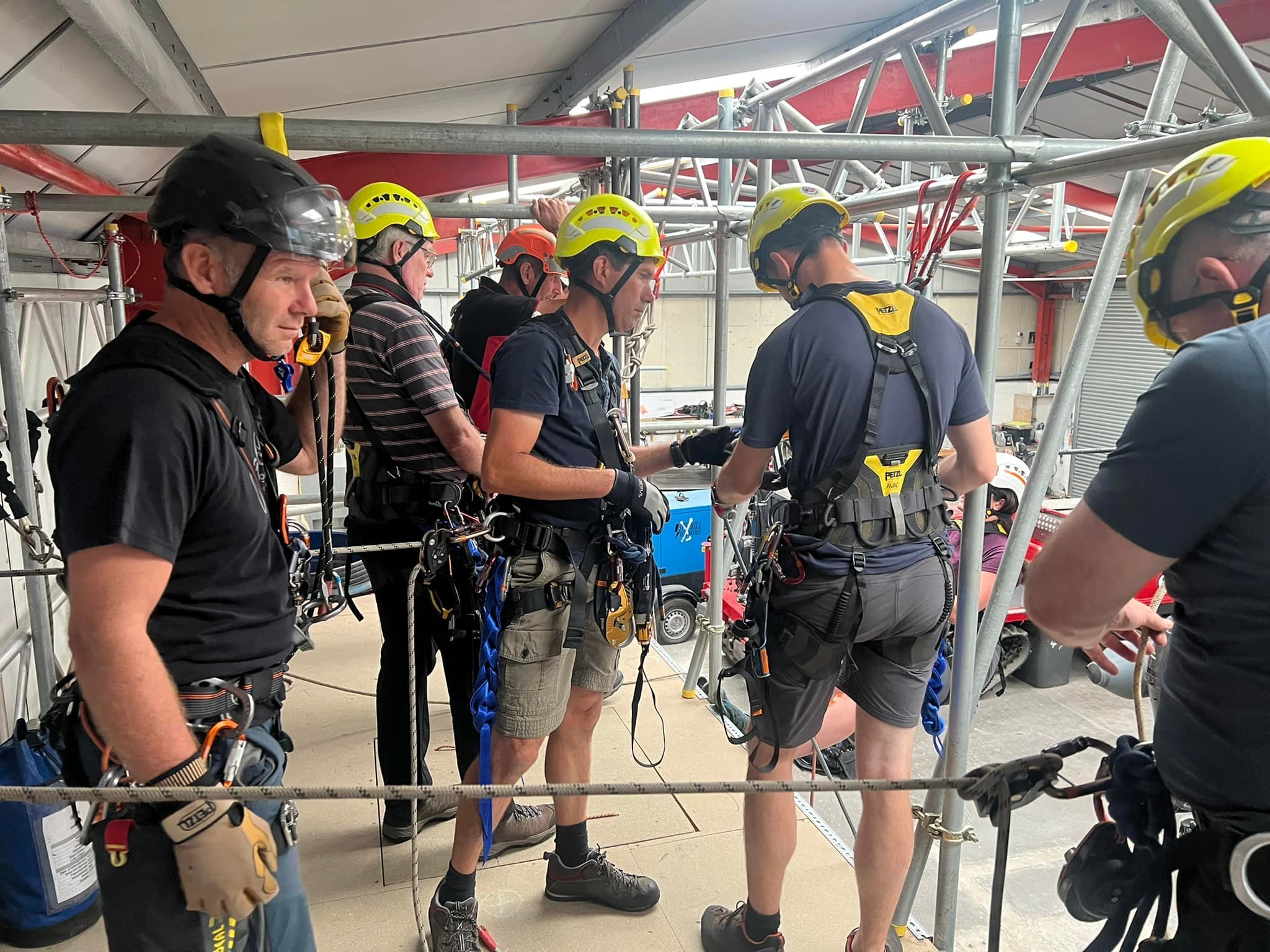
The team has to be ready to rescue fallen climbers or those who may be in inaccessible crags on a Tor. To do this, we have to train with, and maintain a lot of kit!
All members of the team undertake continuous training on rope knowledge and skills required by personnel to operate safely and effectively as a team. Those in the Ropes Team train further to Rope Rescue Operator (RRO) and Rope Rescue Technician (RRT) standard.
We are also very fortunate to have Rope Rescue Specialists (RRS) on the team who oversee all our training and have a wealth of knowledge and experience.
Introducing Brook, our remarkable search and rescue dog. Brook is a short-haired Labrador and a valued member of our team.
With her experienced handler and team member Rob, she provides us with exceptional search and rescue capabilities.
Trained under the Mountain Rescue Search Dogs England syllabus, she can cover vast areas to find individuals in challenging environments.
We are proud to have them both as part of our team

Search Dog Team
UAV / Drone operations

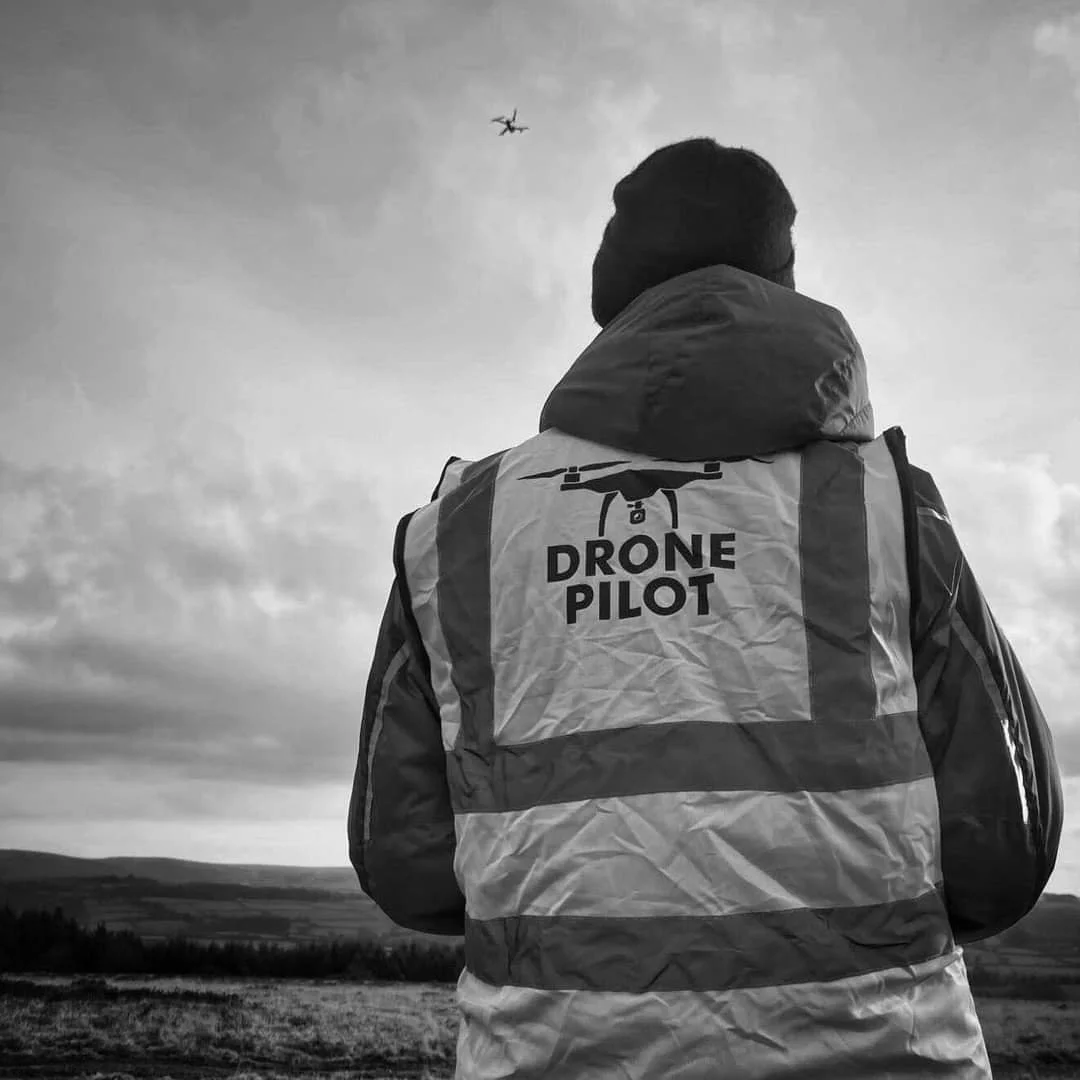
The team offers a cutting-edge Search and Rescue UAV/Drone service for “Initial Visual Search” operations.
Our highly trained professionals utilise state-of-the-art drones equipped with advanced imaging technology to swiftly cover large areas, even in challenging terrains.
These drones play a crucial role in providing real-time aerial footage and visual data during Search and Rescue operations.
We leverage technology to enhance our lifesaving efforts and bring peace of mind to families and communities in need.
Drone footage over Lee Moor

Rescue Centre
Our strategically positioned headquarters serves as the operational hub for our dedicated team of search and rescue professionals.
Equipped with state-of-the-art facilities and cutting-edge equipment, our Rescue Centre enables us to swiftly and efficiently respond to emergencies within the Dartmoor region and beyond.
Learn how to stay safe: Mountain Rescue England & Wales have a fantastic area on their website about how best to prepare for an outdoors adventure, and to stay safe while doing so. Visit their Stay Safe page here.
Check up to date weather forecasts: Always check the weather before heading out, here is the latest weather for Princetown in the middle of Dartmoor from the Met Office.
Check for any flood warnings: If your route is taking you anywhere near any water course, do also check the Environment Agency website for any local flood alerts in advance.
View & download a helpful PDF: Short PDF created by Mountain Rescue England & Wales titled ‘How To Stay Safe’
